Today is mostly a visual tour. No energy to write with much “meaning”, and a very interesting day for travels.
Moving left to right, we were asleep (night time) through most of Nevada. Going through Grand Junction brought back memories of a crush I had on a girl from there when I was in college. sigh…
The mud slides described below occurred around Glenwood Springs, just past Grand Junction.
We woke up Fri morning well into Utah so I (unfortunately) missed photos of the Great Salt Lake.. We were already a couple of hours late because of freight trains ahead of us.
The images below are in rough order of what we travelled through on Friday.
We were warned that mud slides in Colorado may force the train to stop and we’d be given “alternate transportation” to Chicago (busses -blargh!). Spoiler alert – we didn’t have to stop. but it was close. It is hard to give a perspective on the damage and debris from the slide that occurred on July 28 (I think), but if you’re interested, there is a good writeup with images at https://www.cpr.org/2021/08/02/colorado-disaster-declaration-interstate-70-glenwood-canyon-closed-mudslide/
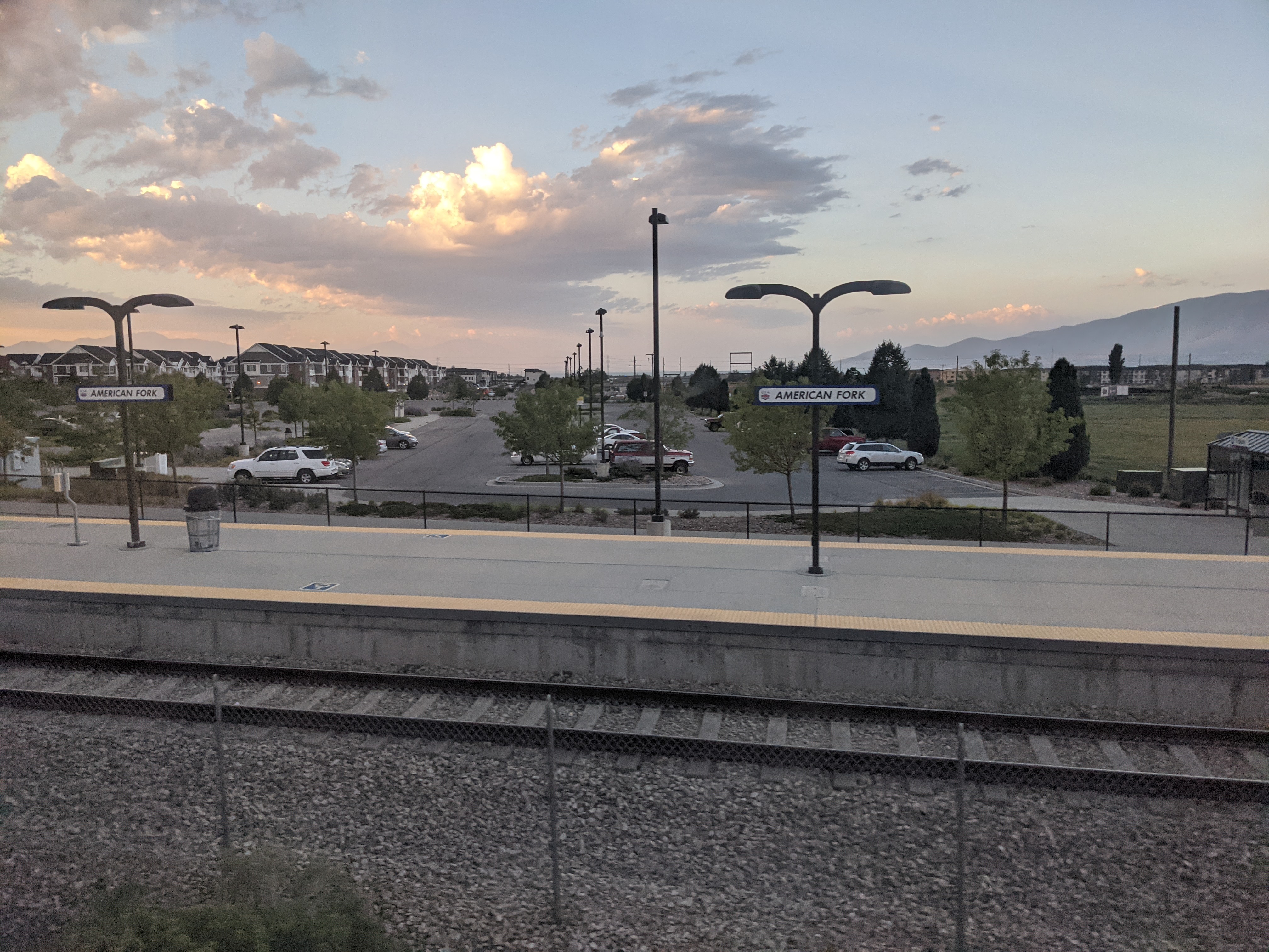
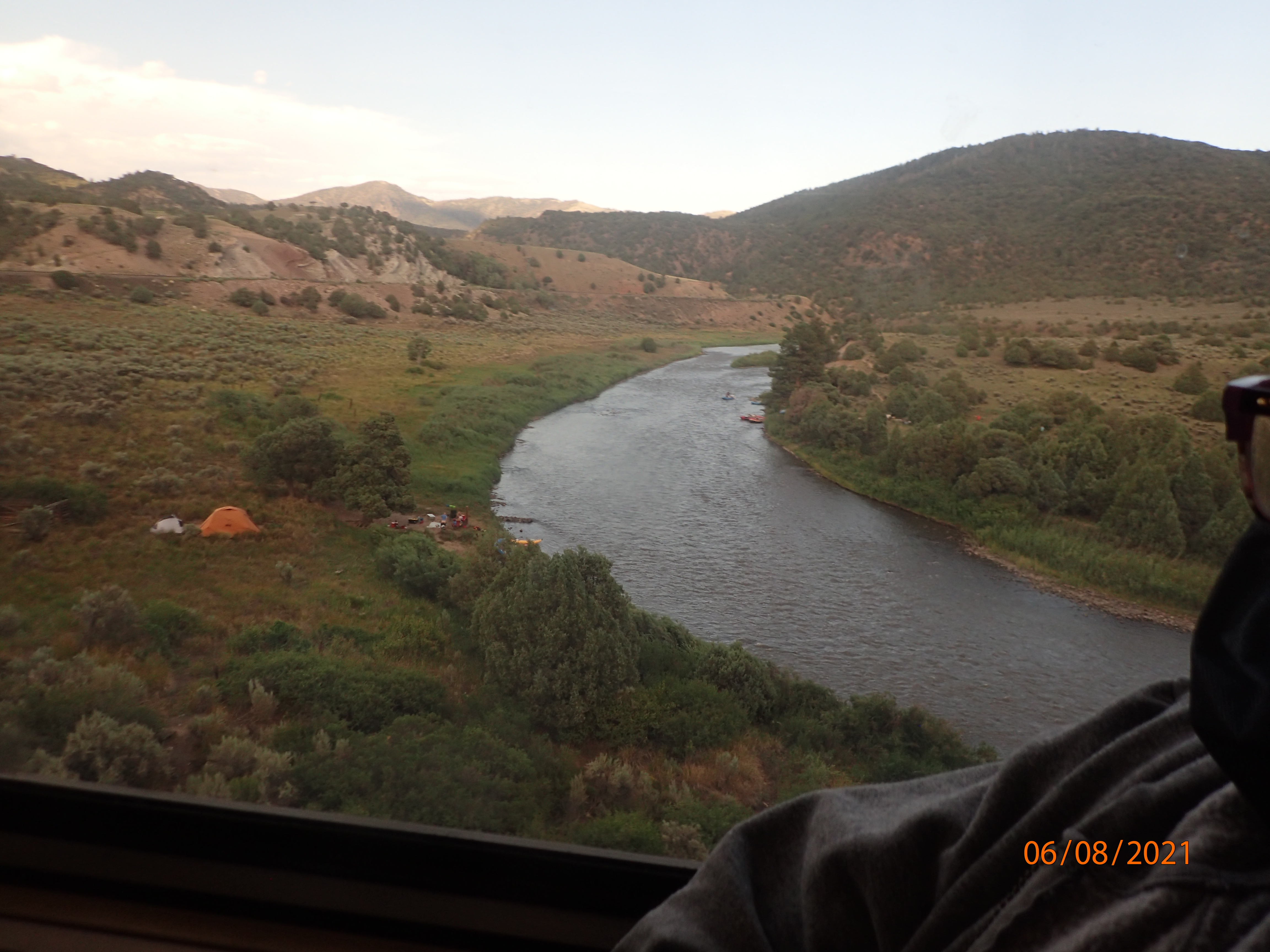
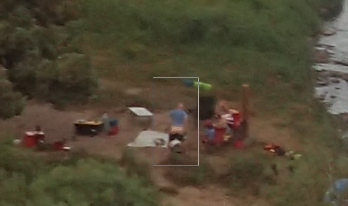
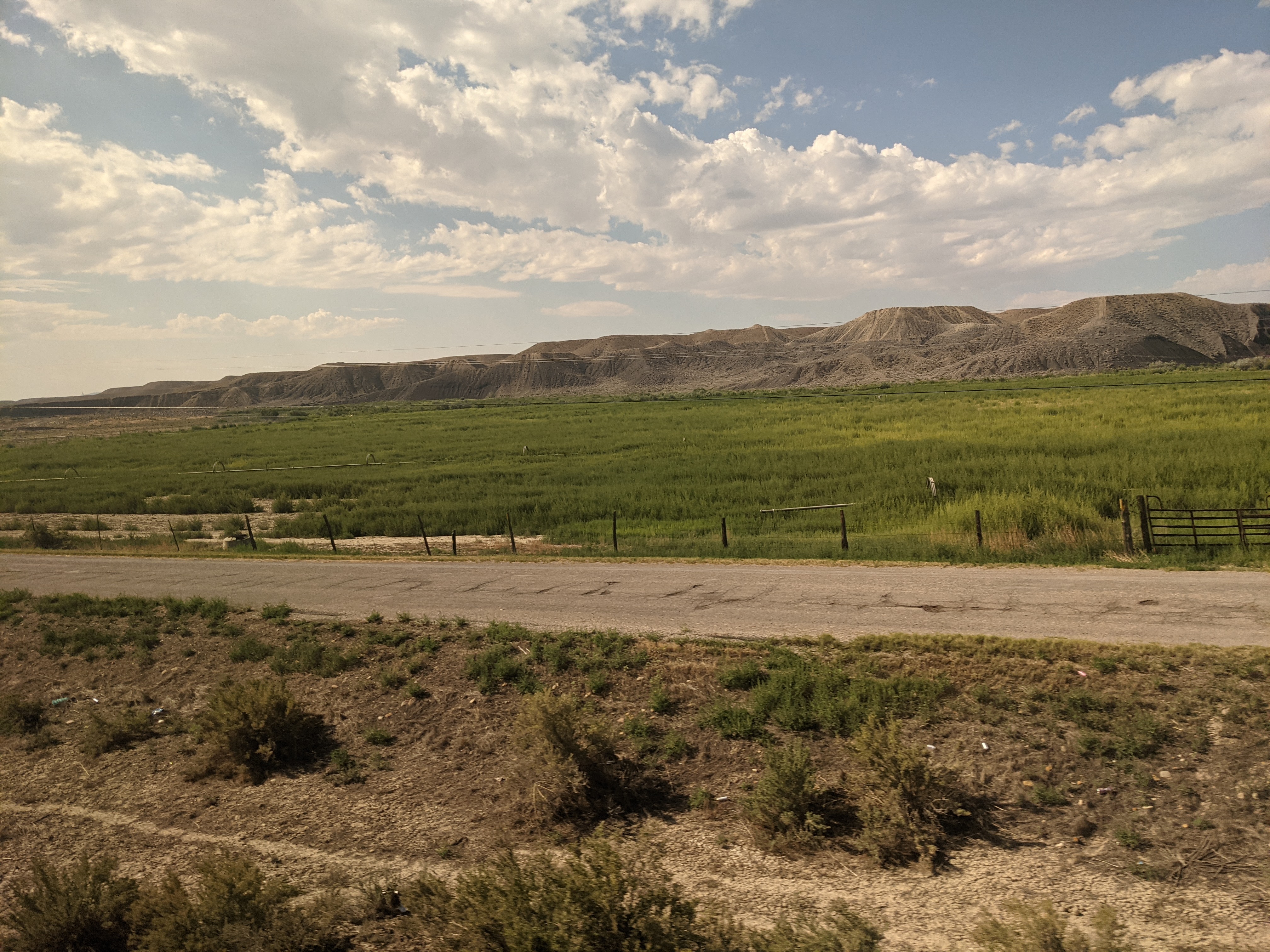
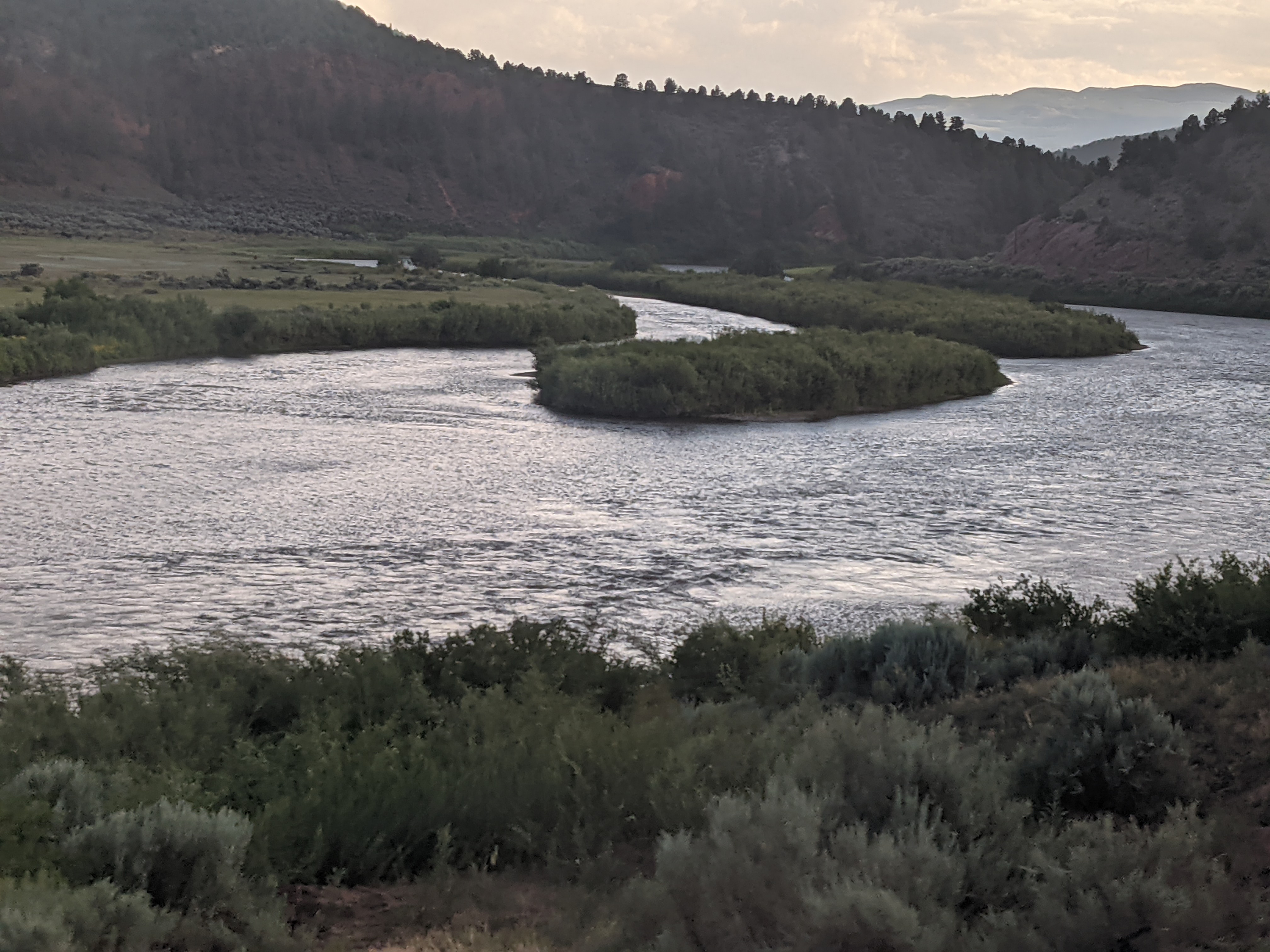
Small towns always marked with retro-feeling signs at the train stops – like this one for American Fork, Utah. We pass through many small towns – like this one in Helper, Utah.A typical view of the river enroute. Camping out and boating on the river in inflatables in a very popular local outing. We saw dozens of similar setups along the way. Turns out there is apparently a local custom – look carefully at the guy in the photo close to the river “mooning” the train! Now aren’t you glad I pointed that out to you? LOL. Farmland under low hills in Utah, gave way to …
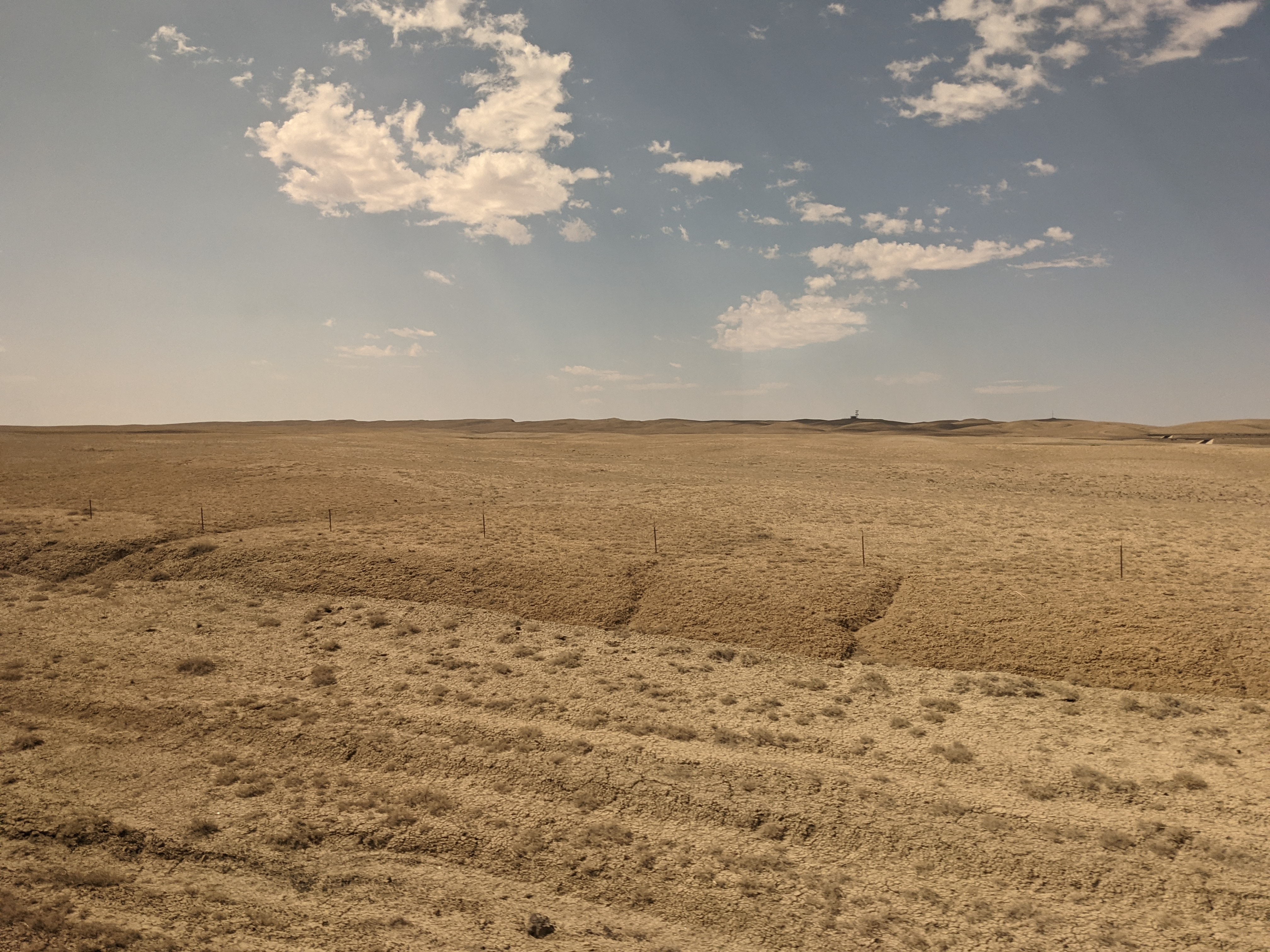
High desert scrub desert, then to …Desert with no scrub brush. Also the next video.
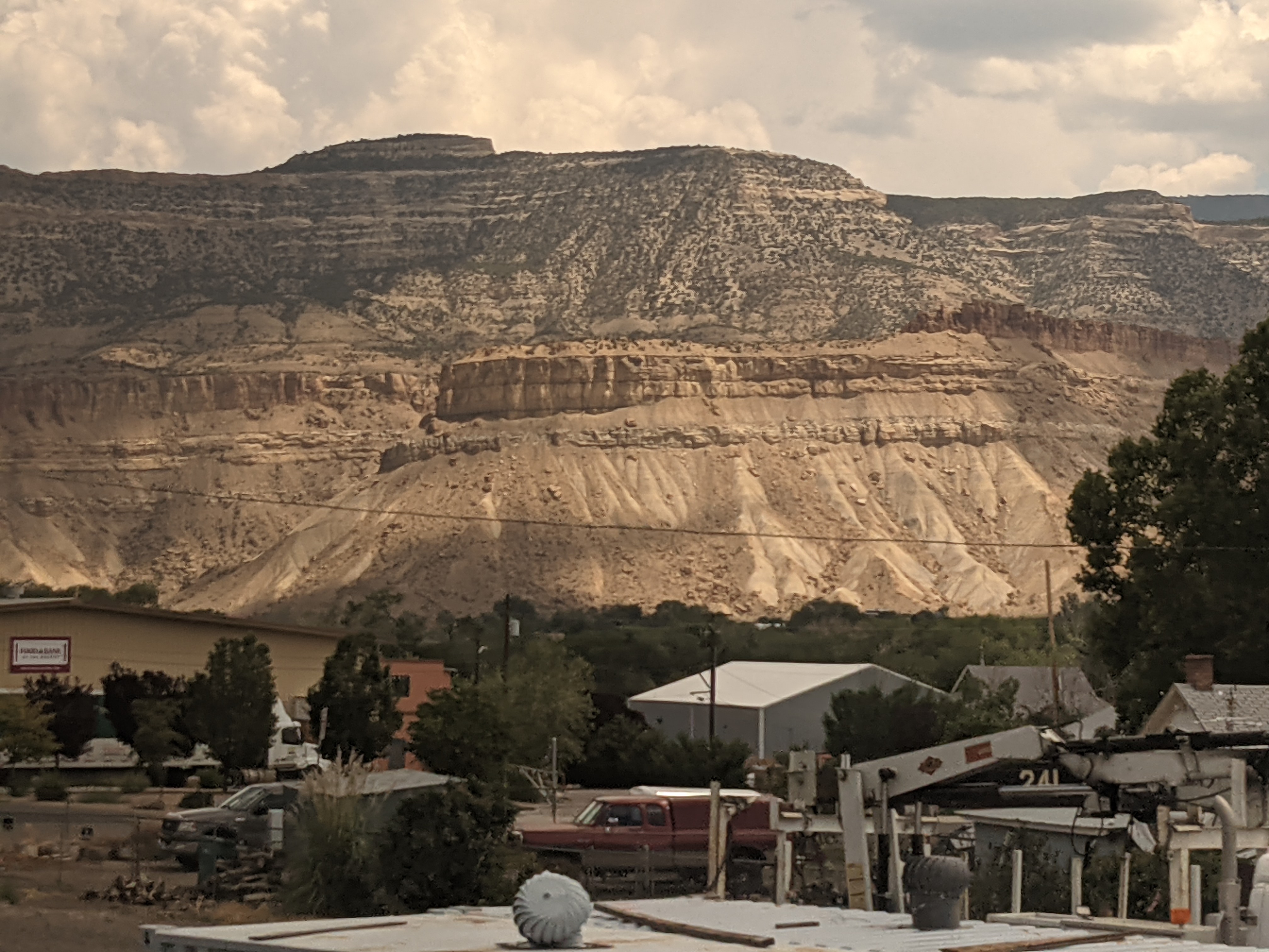
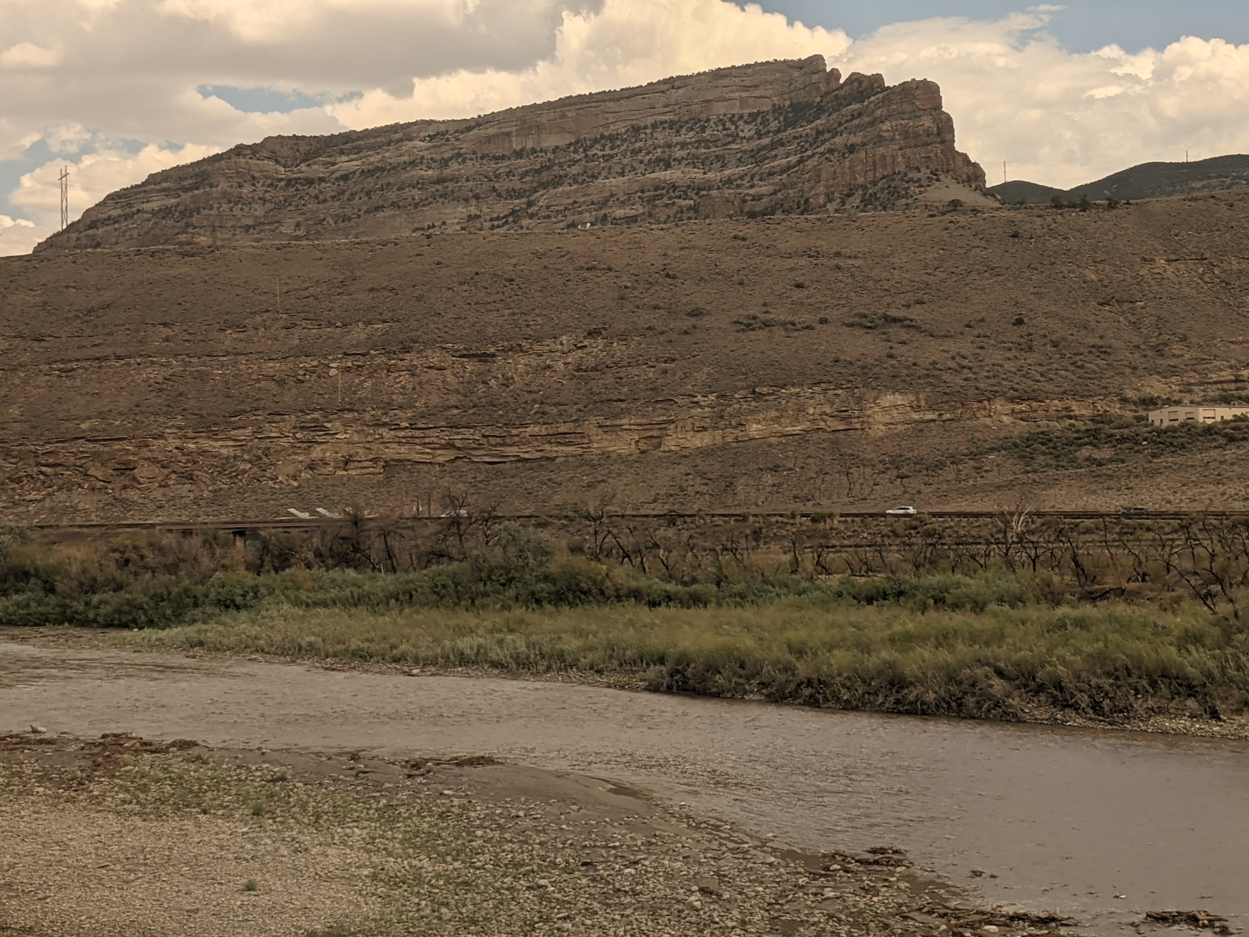
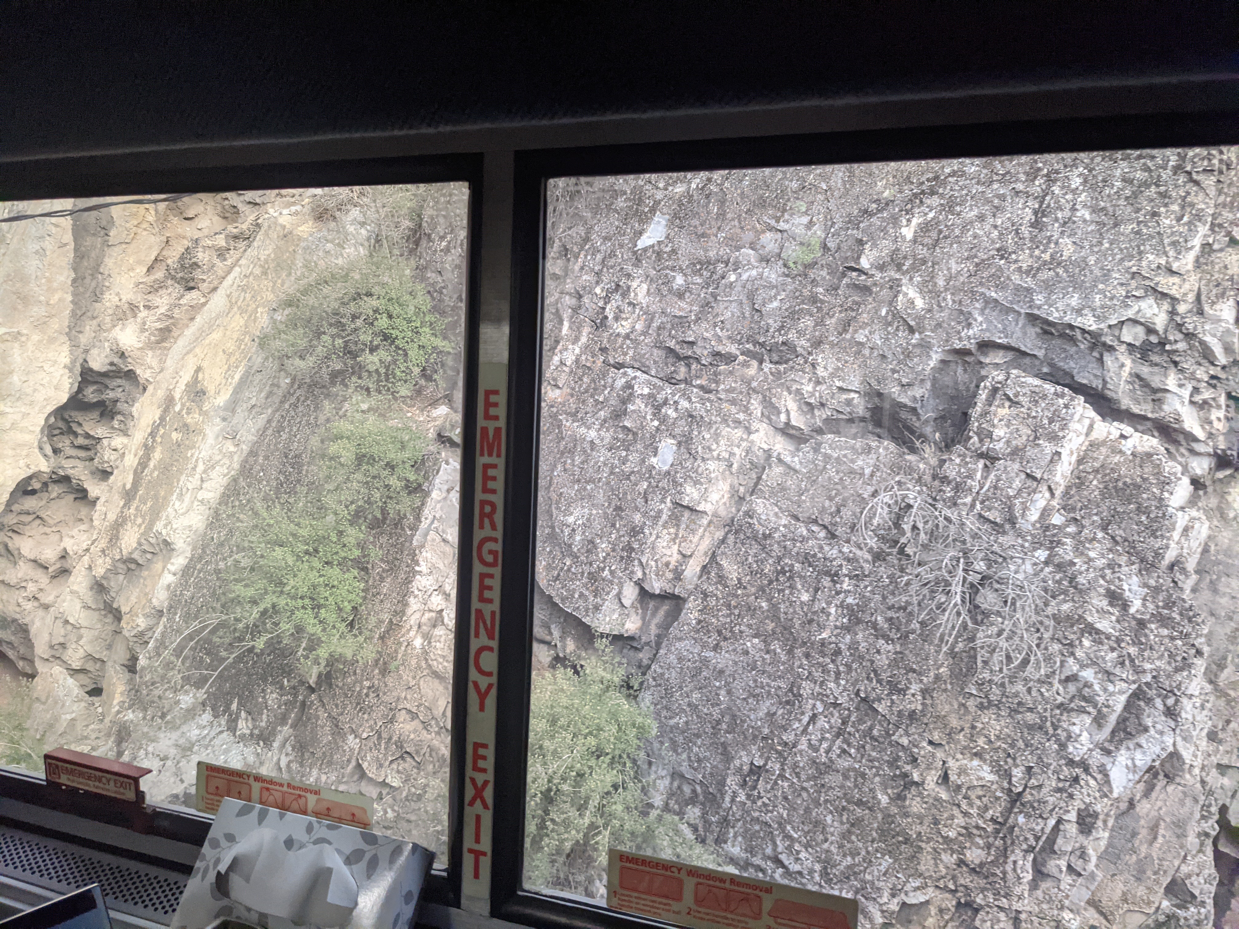
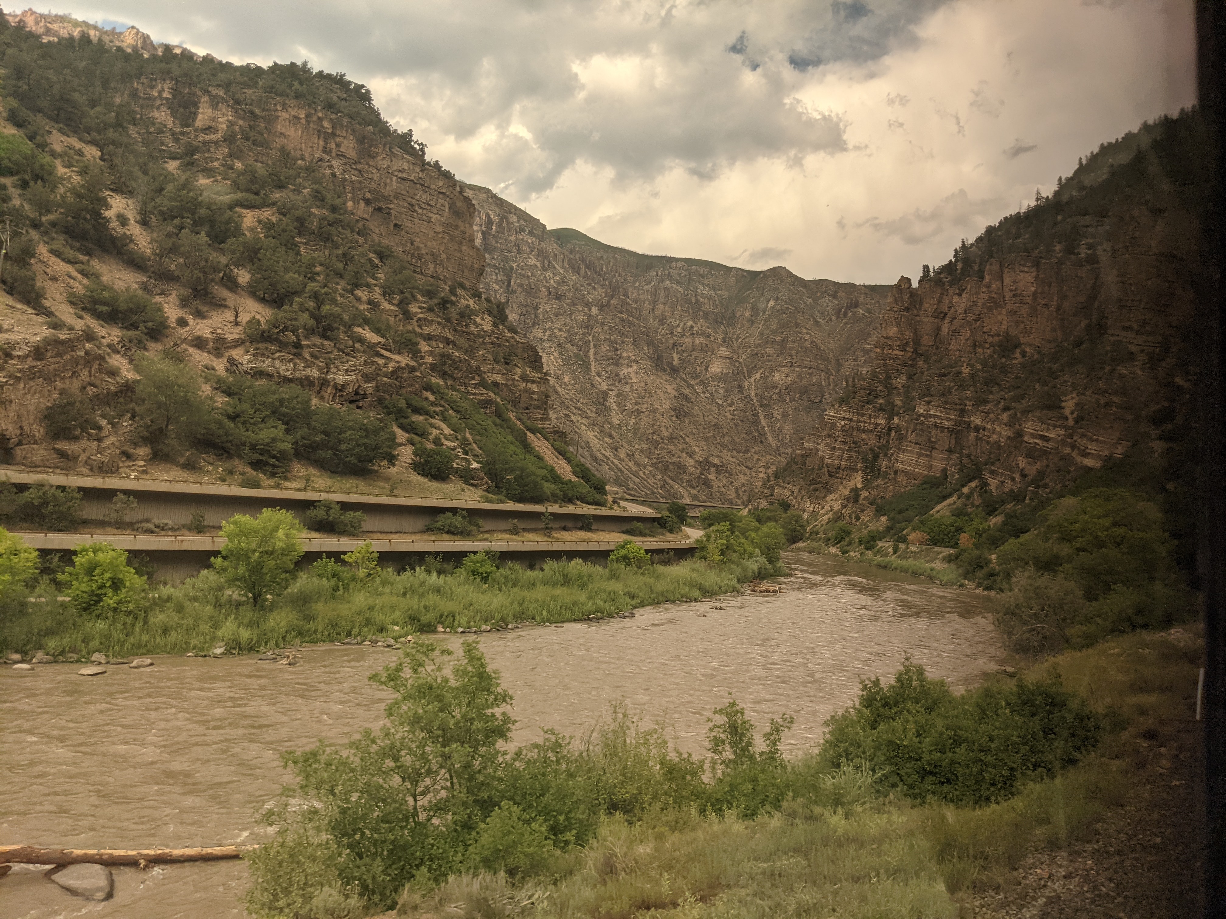
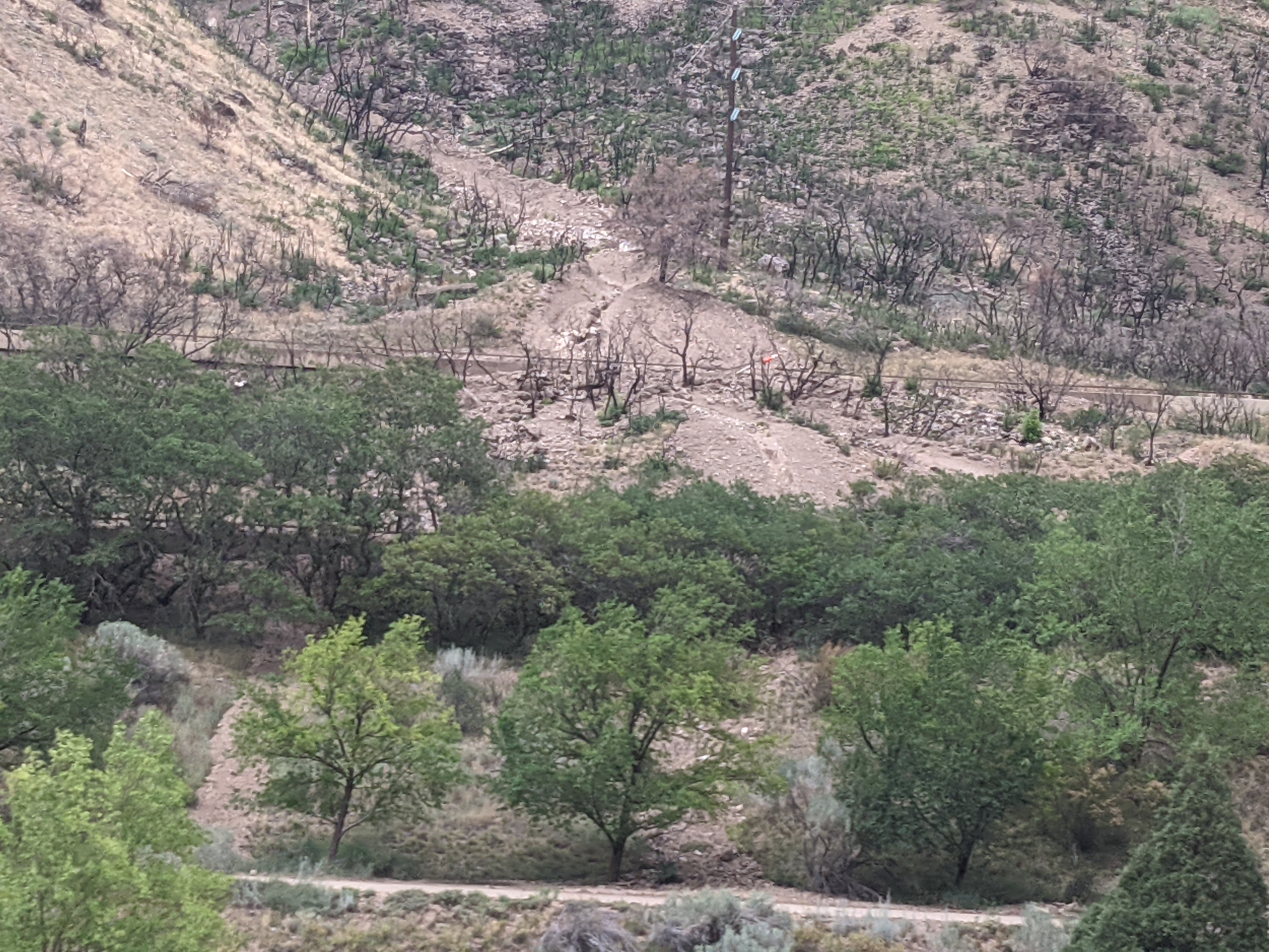
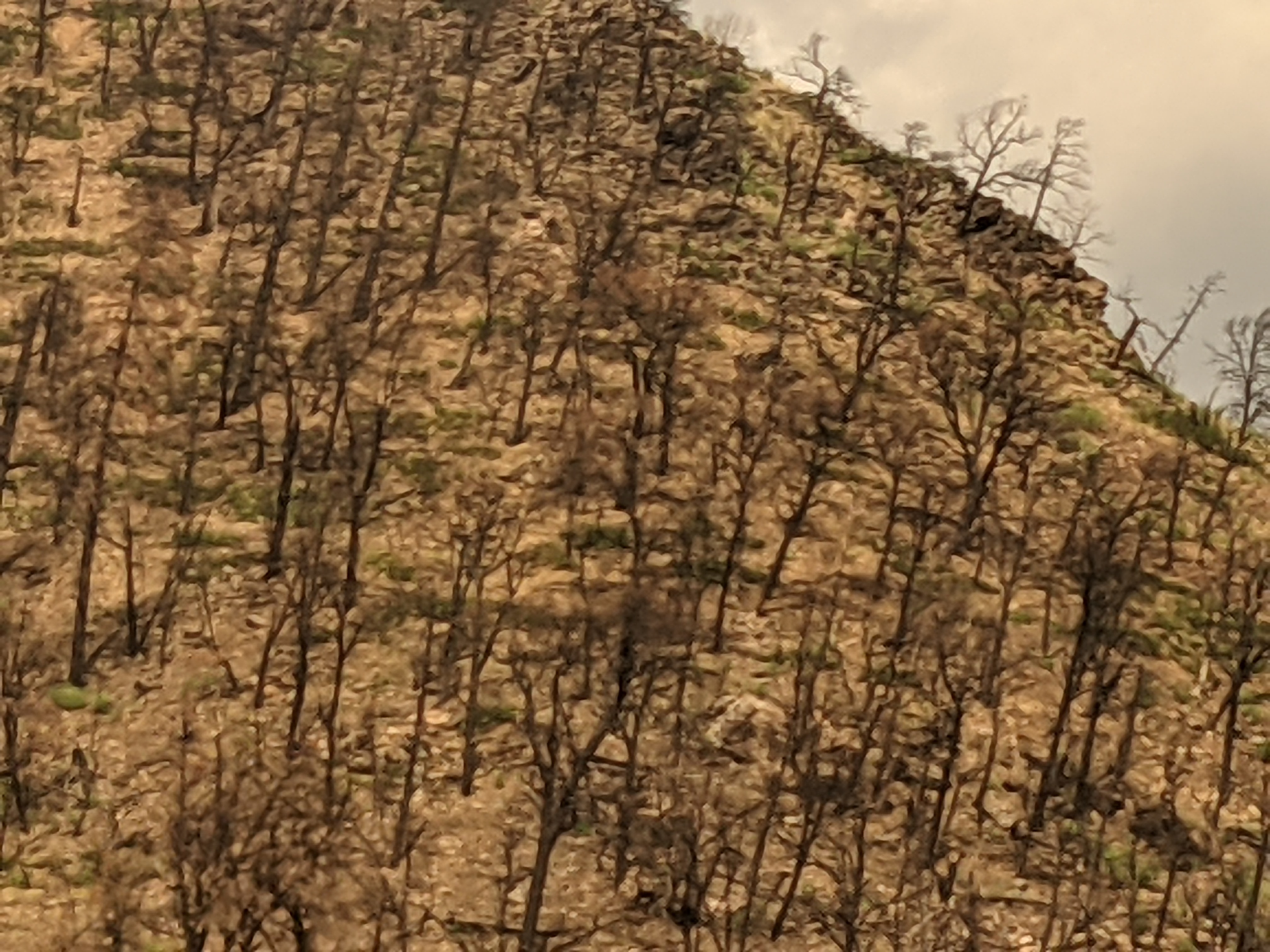
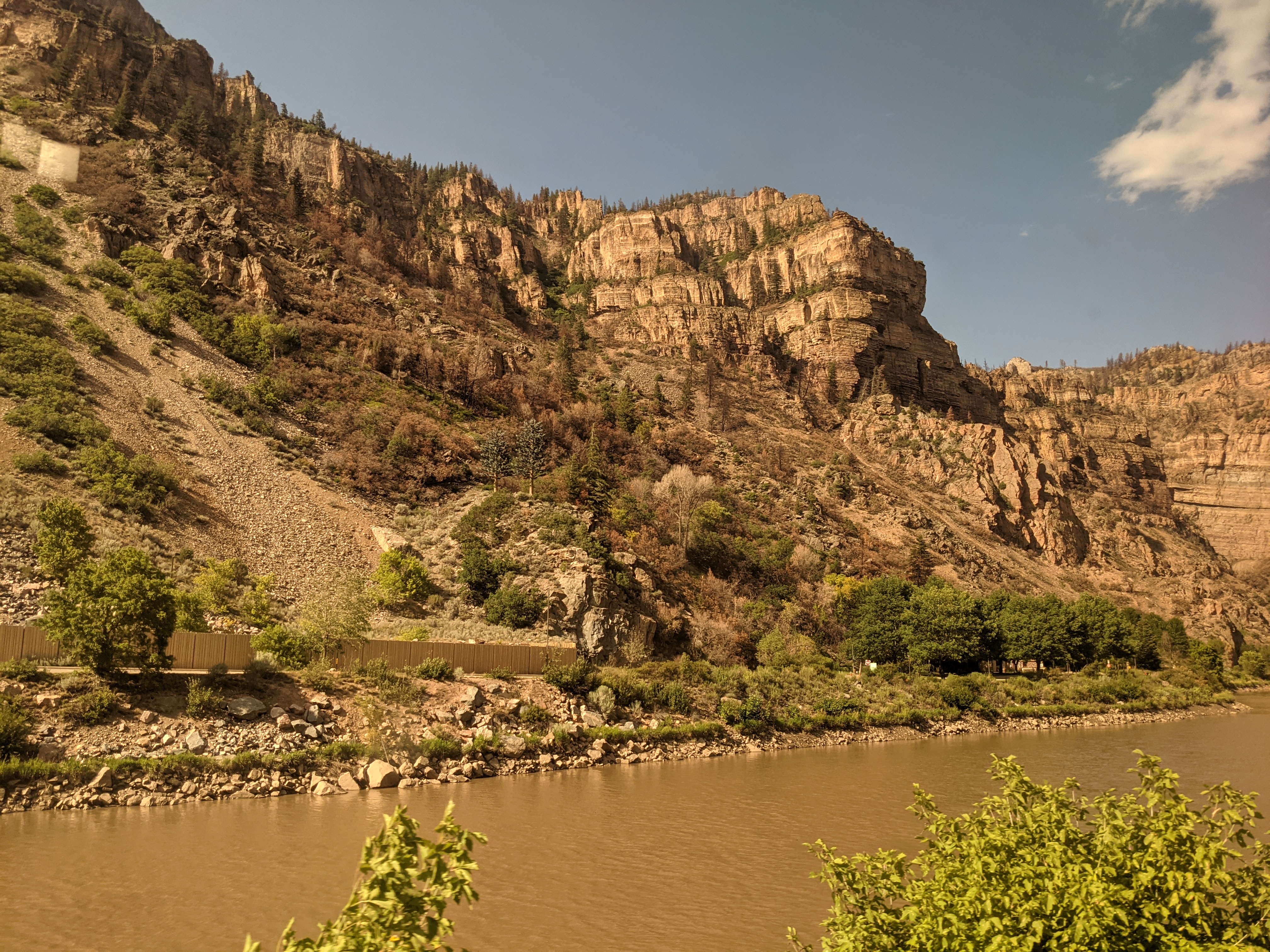
Miles, and miles — and miles. Small town in spectacular scenery. Somewhere in Colorado or Eastern Utah. Beautiful! Entering Glenwood Springs – people waiting for the train westbound. Note the Amish (or Mennonite?), or “old school” Morman attire of the people on the right. Sorry, I don’t know for sure. Entering the canyon – rock walls were about 1 meter from the train! A view in Glenwood Springs Canyon just prior to the mud slides. Note the two level highway on the left. That I-70 – Eastbound top level, Westbound bottom level, and a bicycle track below that that went the entire distance. Both top and bottoms are 2 lanes. One of the areas of mud slide. You can make out the two lanes of the freeway on the left side of the photo (bottom level through the trees), and see where the slide in this area covered both roads. The bicycle track can be seen at the bottom. Note the burned trees from previous wildfires – possibly a contributing cause for the mud slides by destabilizing the dirt.
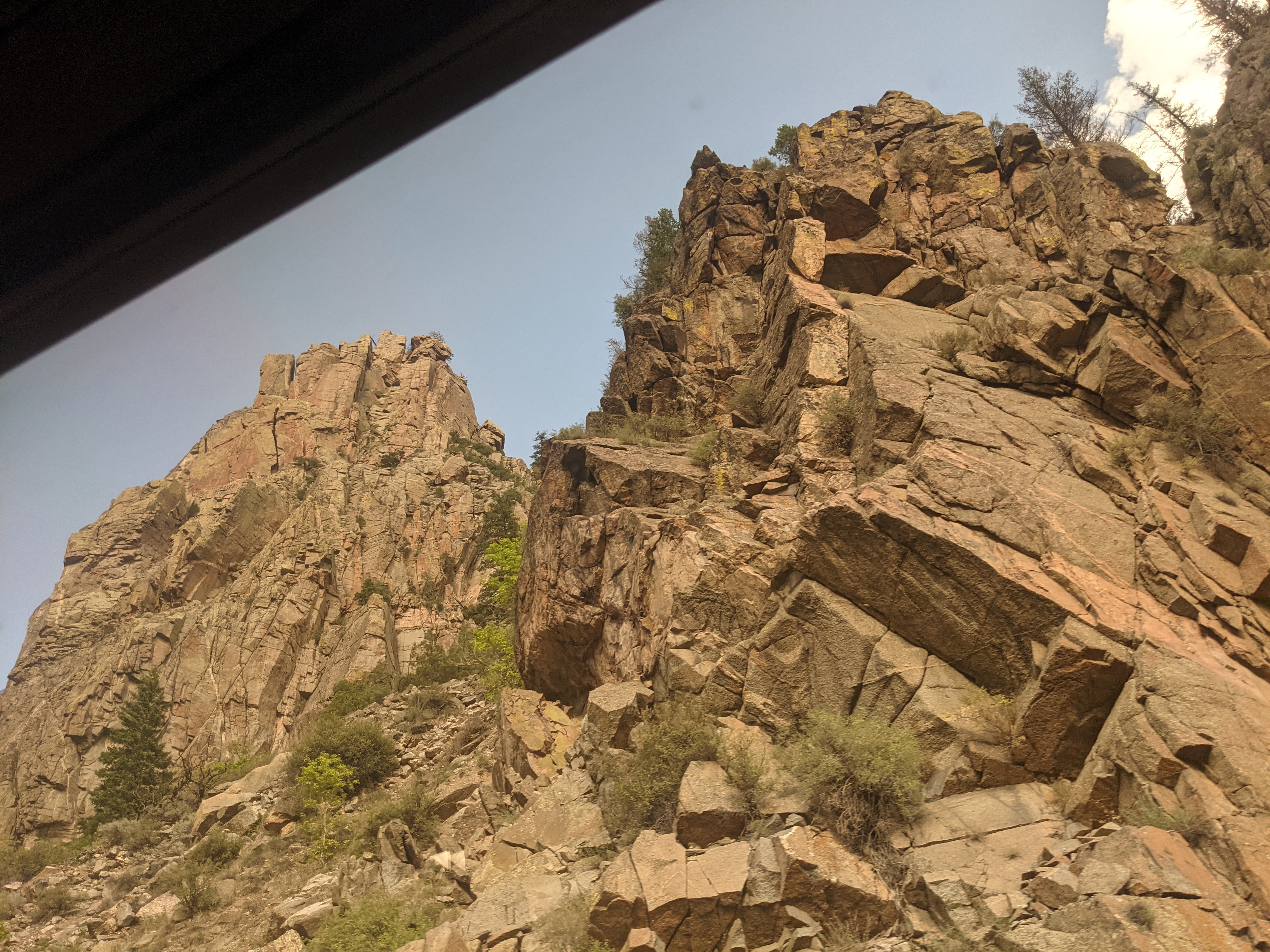
Another slide area in video. Wildfire damage.This is looking straight up from my window – the top of the nearest rock peak is probably 100 meters high or more, and there are MUCH higher peaks behind that!
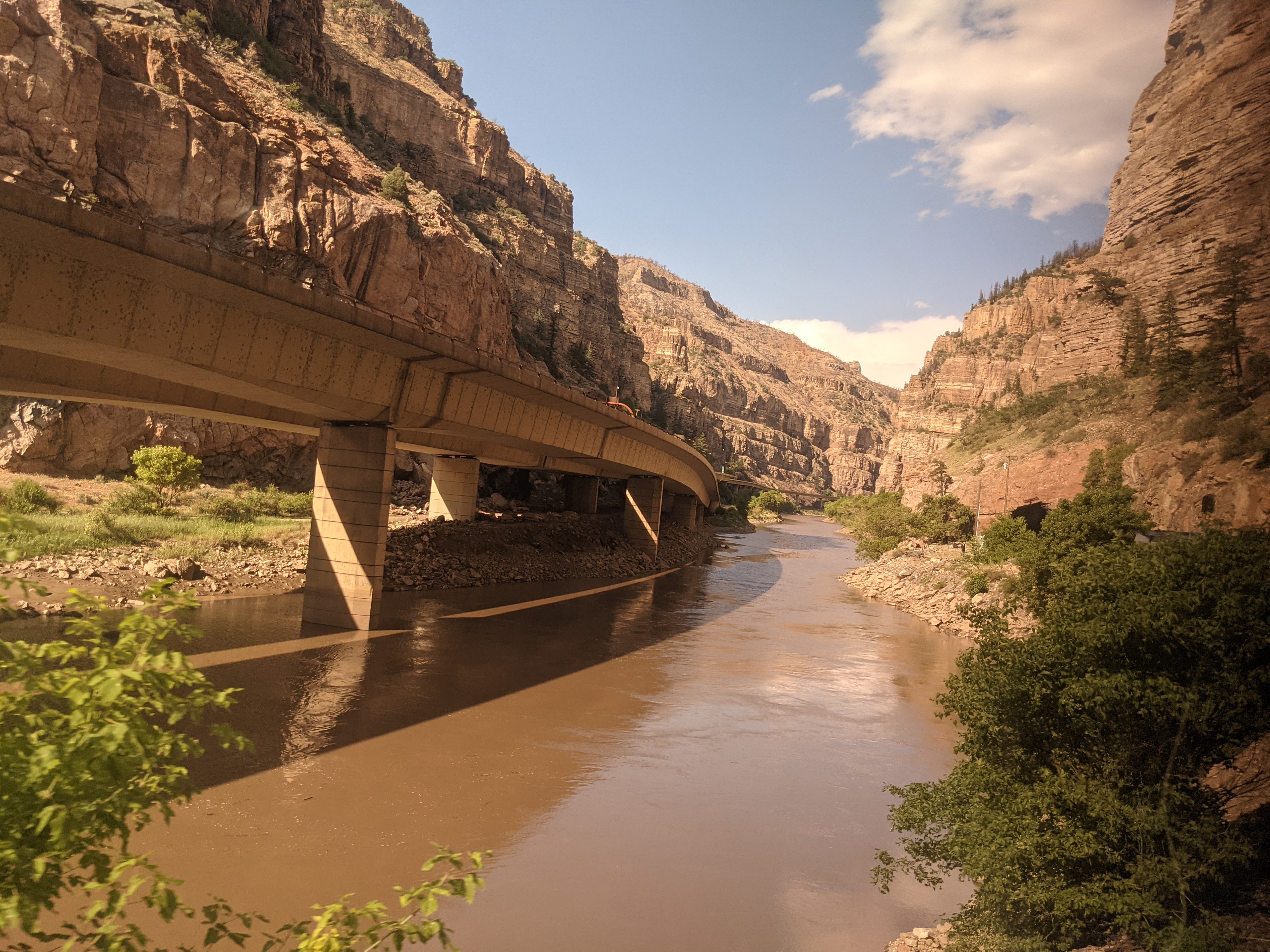
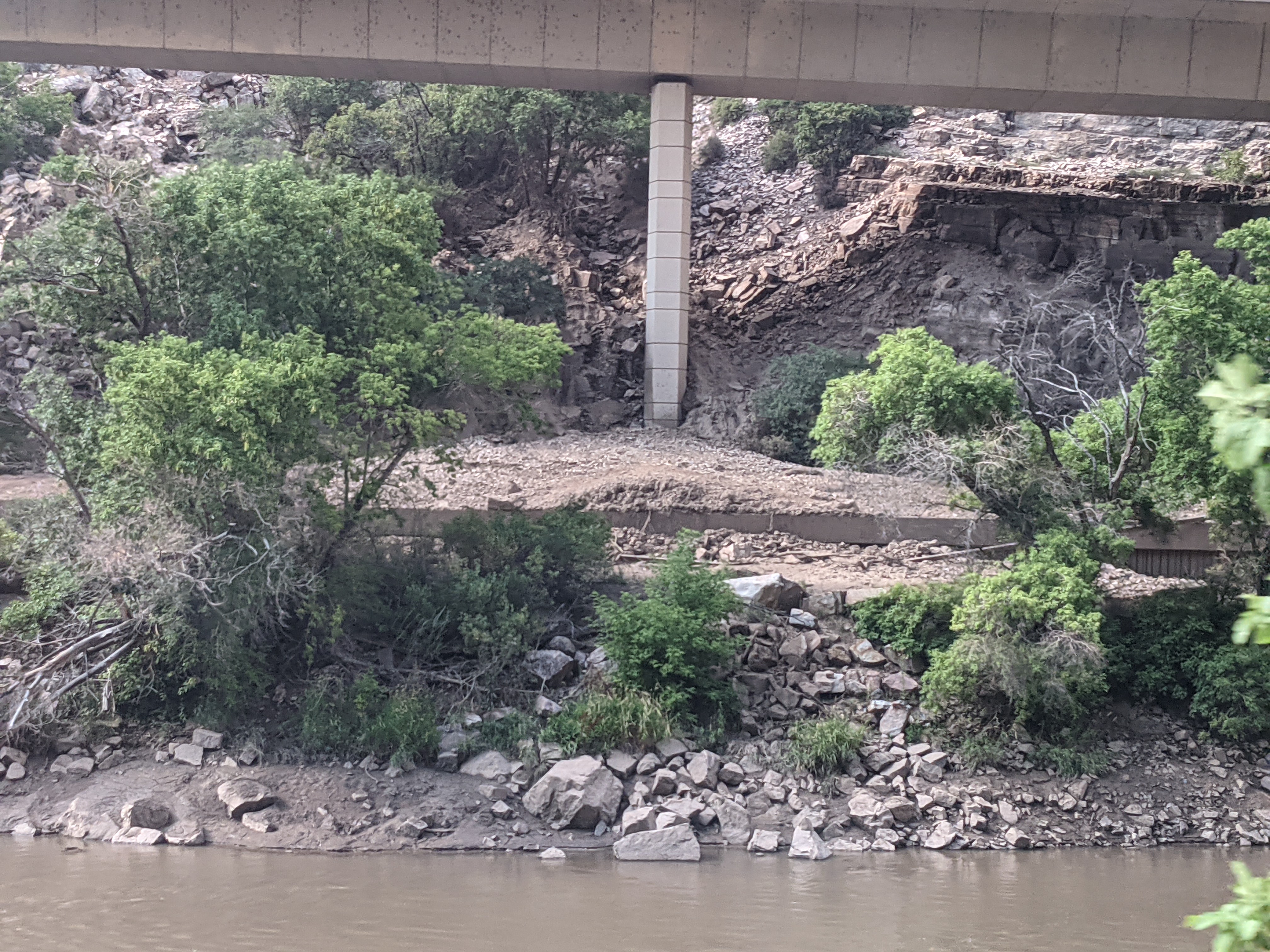
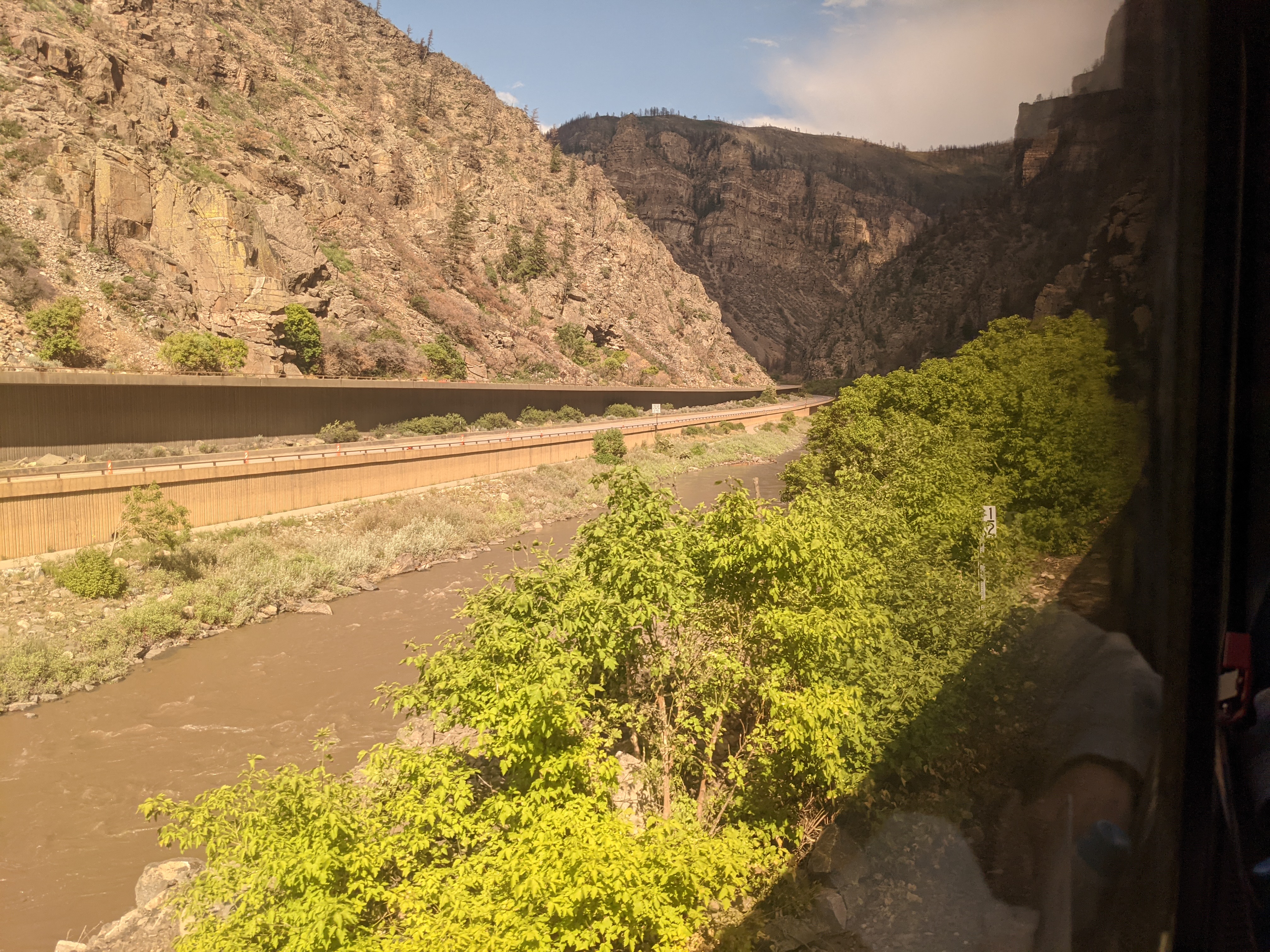
Video of the mountains just beside the train. We went VERY slowly so the engineers could ensure the track was clear. Fine by me! Starting to come out of the mud slide area, but note the slide on the left covering the upper road and spilling onto the lower road. The mudslides changed the course of the Colorado River. In this photo, the river literally covers the lower road. Note the slide went below the upper level here (the vertical beam is the highway support), and completely covered the lower road. You can see bare traces of the bicycle path below the lower road. After most of the damage. This is what the freeway normally looks like. Beautiful! The Colorado River after leaving the canyon and before entering Denver.
About this point, I went to bed after dark, and slept through a stop on Denver.